 vesseltracker.com
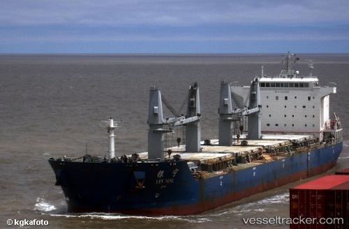
Vessel Yin Ning IMO: 9396892, MMSI: 413336000 Bulk Carrier
UTC, 0.88687, 119.11938, course: 25, speed: 10.5
UTC, 1.22667, 119.19667, course: -1, speed: 10
2026-02-17 08:27:29 UTC, 1.75500, 119.27500, course: -1, speed: 9
Live AIS position:
UTC. 70 nm E of Muara Pantai),
updated 2026-02-17 08:27:29 UTC.
Find the position of the vessel Yin Ning on the map. The latter are known coordinates and path.
marine traffic ship tracker show on live map
The current position of vessel Yin Ning is 1.75500 lat / 119.27500 lng. Updated: 2026-02-17 08:27:29 UTCDetails:
Last coordinates of the vessel:
UTC, 0.74500, 119.04333, course: -1, speed: 10UTC, 0.88687, 119.11938, course: 25, speed: 10.5
UTC, 1.22667, 119.19667, course: -1, speed: 10
2026-02-17 08:27:29 UTC, 1.75500, 119.27500, course: -1, speed: 9