 vesseltracker.com
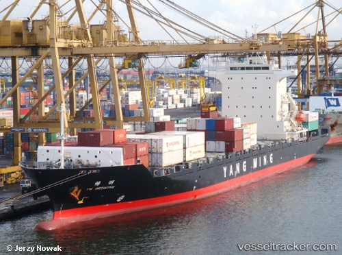
Vessel Ym Initiative IMO: 9319090, MMSI: 636012797 Container Ship
UTC, 22.01594, 114.13318, course: 75, speed: 0.2
UTC, 22.01549, 114.13339, course: 67, speed: 0.1
2026-02-18 17:35:48 UTC, 22.01561, 114.13326, course: 67, speed: 0.1
Live AIS position:
UTC. Near WAILINGDING ISLAND),
updated 2026-02-18 17:35:48 UTC.
Find the position of the vessel Ym Initiative on the map. The latter are known coordinates and path.
marine traffic ship tracker show on live map
The current position of vessel Ym Initiative is 22.01561 lat / 114.13326 lng. Updated: 2026-02-18 17:35:48 UTCCurrently sailing under the flag of Liberia
Ym Initiative built in 2007 year
Deadweight:
22027 tDetails:
Last coordinates of the vessel:
UTC, 22.01602, 114.13319, course: 88, speed: 0.1UTC, 22.01594, 114.13318, course: 75, speed: 0.2
UTC, 22.01549, 114.13339, course: 67, speed: 0.1
2026-02-18 17:35:48 UTC, 22.01561, 114.13326, course: 67, speed: 0.1