 vesseltracker.com
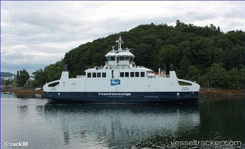
Vessel Ytteroey IMO: 9724130, MMSI: 258046000 Passenger Ro Ro Cargo Ship
UTC, 67.43880, 14.76266, course: 240, speed: 0
UTC, 67.43880, 14.76268, course: 61, speed: 0
2026-02-14 21:33:00 UTC, 67.45265, 14.73042, course: 299, speed: 0
Live AIS position:
UTC. Near Misten),
updated 2026-02-14 21:33:00 UTC.
Find the position of the vessel Ytteroey on the map. The latter are known coordinates and path.
marine traffic ship tracker show on live map
The current position of vessel Ytteroey is 67.45265 lat / 14.73042 lng. Updated: 2026-02-14 21:33:00 UTCCurrently sailing under the flag of Norway
Details:
Last coordinates of the vessel:
UTC, 67.43878, 14.76271, course: 240, speed: 0UTC, 67.43880, 14.76266, course: 240, speed: 0
UTC, 67.43880, 14.76268, course: 61, speed: 0
2026-02-14 21:33:00 UTC, 67.45265, 14.73042, course: 299, speed: 0