 vesseltracker.com
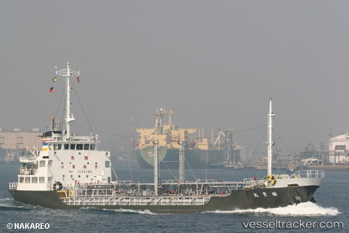
Vessel Yuhomaru IMO: 8910782, MMSI: 533064300 Oil Products Tanker
UTC, 6.05372, 116.00174, course: -1, speed: 8.5
UTC, 6.01900, 116.08841, course: -1, speed: 0.1
UTC, 6.01904, 116.08840, course: -1, speed: 0.2
UTC, 6.01904, 116.08840, course: -1, speed: 0.2
2026-02-14 07:14:12 UTC, 6.01904, 116.08840, course: -1, speed: 0.2
Live AIS position:
UTC. Near Kota Kinabalu),
updated 2026-02-14 07:14:12 UTC.
Find the position of the vessel Yuhomaru on the map. The latter are known coordinates and path.
marine traffic ship tracker show on live map
The current position of vessel Yuhomaru is 6.01904 lat / 116.08840 lng. Updated: 2026-02-14 07:14:12 UTCDetails:
Last coordinates of the vessel:
UTC, 5.96079, 115.79354, course: -1, speed: 7.9UTC, 6.05372, 116.00174, course: -1, speed: 8.5
UTC, 6.01900, 116.08841, course: -1, speed: 0.1
UTC, 6.01904, 116.08840, course: -1, speed: 0.2
UTC, 6.01904, 116.08840, course: -1, speed: 0.2
2026-02-14 07:14:12 UTC, 6.01904, 116.08840, course: -1, speed: 0.2