 vesseltracker.com
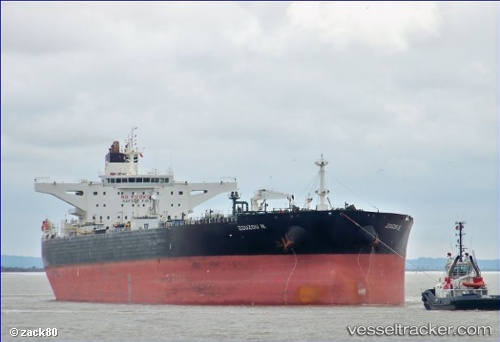
Vessel Zouzou N IMO: 9410222, MMSI: 636014251 Crude Oil Tanker
UTC, 17.90590, 39.77610, course: 180, speed: 12.1
UTC, 17.90590, 39.77610, course: 180, speed: 12.1
2026-02-05 14:43:35 UTC, 17.90590, 39.77610, course: 180, speed: 12.1
Live AIS position:
UTC. 103 nm SW of Al Qunfudah),
updated 2026-02-05 14:43:35 UTC.
Find the position of the vessel Zouzou N on the map. The latter are known coordinates and path.
marine traffic ship tracker show on live map
The current position of vessel Zouzou N is 17.90590 lat / 39.77610 lng. Updated: 2026-02-05 14:43:35 UTCCurrently sailing under the flag of Liberia
Zouzou N built in 2010 year
Deadweight:
149991 tDetails:
Last coordinates of the vessel:
UTC, 17.98346, 39.73557, course: 142, speed: 11.9UTC, 17.90590, 39.77610, course: 180, speed: 12.1
UTC, 17.90590, 39.77610, course: 180, speed: 12.1
2026-02-05 14:43:35 UTC, 17.90590, 39.77610, course: 180, speed: 12.1