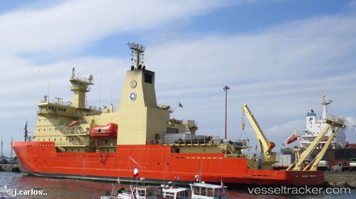
Find the position of the vessel Nathaniel B Palmer on the map. The latter are known coordinates and path.
marine traffic ship tracker show on live map
The current position of vessel Nathaniel B Palmer is -36.6726 lat / -73.0578 lng. Updated: 2025-06-02 10:46:51 UTCCurrently sailing under the flag of USA
Nathaniel B Palmer built in 1992 year
Home port:
Galliano (human settlement in Louisiana, United States of America)Port of registry:
Galliano (human settlement in Louisiana, United States of America)Deadweight:
2500 tPayload_mass:
2500 tonneGross tonnage:
6174Net tonnage:
1852 Beam:
18.288 metreOperator:
Lockheed Martin (US aerospace and defense manufacturer)Service entry:
1992-01-01T00:00:00ZLocation of creation:
Larose (human settlement in Louisiana, United States of America)Named after:
Nathaniel Palmer (American explorer (1799–1877))Manufacturer:
North American Shipbuilding (American shipbuilding company and shipyard in Larose, Louisiana, U.S.)Owned:
Edison Chouest Offshore (family of marine transportation companies)Details:
Last coordinates of the vessel:
UTC, -36.6726, -73.0579, course: 191, speed: 0UTC, -36.6726, -73.0577, course: 203, speed: 0
UTC, -36.6725, -73.0578, course: 196, speed: 0
2025-06-02 10:46:51 UTC, -36.6726, -73.0578, course: 181, speed: 0
Track of the vessel in the last 14 days
The ship also appears on the maps: