 vesseltracker.com
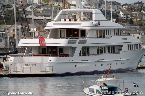
Vessel Teleost IMO: 1006219, MMSI: 319451000 Service Ship
UTC, -37.67328, 176.17197, course: 270, speed: 0
UTC, -37.67328, 176.17197, course: 269, speed: 0
2026-01-17 12:17:40 UTC, -37.67328, 176.17197, course: 269, speed: 0
Live AIS position:
UTC. Near Mount Maunganui),
updated 2026-01-17 12:17:40 UTC.
Find the position of the vessel Teleost on the map. The latter are known coordinates and path.
marine traffic ship tracker show on live map
The current position of vessel Teleost is -37.67328 lat / 176.17197 lng. Updated: 2026-01-17 12:17:40 UTCCurrently sailing under the flag of Cayman Is
Teleost built in 1998 year
Details:
Last coordinates of the vessel:
UTC, -37.67329, 176.17197, course: 269, speed: 0UTC, -37.67328, 176.17197, course: 270, speed: 0
UTC, -37.67328, 176.17197, course: 269, speed: 0
2026-01-17 12:17:40 UTC, -37.67328, 176.17197, course: 269, speed: 0