 vesseltracker.com
Find the position of the vessel Plan B on the map. The latter are known coordinates and path.
marine traffic ship tracker show on live map
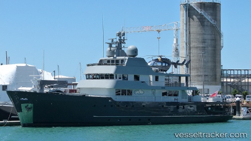
The current position of vessel Plan B is -14.9155 lat / -162.925 lng. Updated: 2025-07-01 04:22:51 UTCCurrently sailing under the flag of Cayman Is
Plan B built in 1973 year
Port of registry:
George Town (capital and largest city of the Cayman Islands)Deadweight:
850 tOperator:
Royal Australian Navy (naval warfare branch of the Australian Defence Force)Service entry:
1973-01-01T00:00:00ZNamed after:
Matthew Flinders (English navigator and cartographer (1774-1814))Manufacturer:
Williamstown DockyardDetails:
Last coordinates of the vessel:
UTC, -14.8578, -163.32, course: 98, speed: 10.3UTC, -14.8747, -163.213, course: 99, speed: 10.3
UTC, -14.895, -163.08, course: 97, speed: 10.2
2025-07-01 04:22:51 UTC, -14.9155, -162.925, course: 81, speed: 3.9