 vesseltracker.com
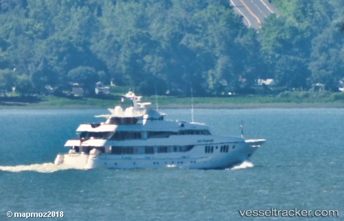
Vessel Blue Moon IMO: 1008360, MMSI: 319984000 Service Ship
UTC, 18.17133, -63.11317, course: 89, speed: 0.3
UTC, 18.17117, -63.11317, course: 72, speed: 0.4
2026-01-18 04:20:04 UTC, 18.17117, -63.11317, course: 79, speed: 0.1
Live AIS position:
UTC. Near ANGUILLA),
updated 2026-01-18 04:20:04 UTC.
Find the position of the vessel Blue Moon on the map. The latter are known coordinates and path.
marine traffic ship tracker show on live map
The current position of vessel Blue Moon is 18.17117 lat / -63.11317 lng. Updated: 2026-01-18 04:20:04 UTCCurrently sailing under the flag of Cayman Is
Blue Moon built in 2005 year
Deadweight:
137 tDetails:
Last coordinates of the vessel:
UTC, 18.17133, -63.11317, course: 84, speed: 0UTC, 18.17133, -63.11317, course: 89, speed: 0.3
UTC, 18.17117, -63.11317, course: 72, speed: 0.4
2026-01-18 04:20:04 UTC, 18.17117, -63.11317, course: 79, speed: 0.1