 vesseltracker.com
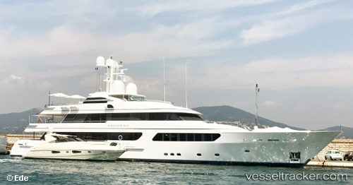
Find the position of the vessel HURRICANE RUN on the map. The latter are known coordinates and path.
marine traffic ship tracker show on live map
The current position of vessel HURRICANE RUN is 43.16884 lat / 5.61177 lng. Updated: 2025-10-31 11:22:50 UTCCurrently sailing under the flag of Cayman Islands
HURRICANE RUN built in 2009 year
Deadweight:
0 tDetails:
Last coordinates of the vessel:
UTC, 43.16833, 5.61167, course: -1, speed: 0UTC, 43.16883, 5.61177, course: 222, speed: 0
UTC, 43.16833, 5.61167, course: -1, speed: 0
2025-10-31 11:22:50 UTC, 43.16884, 5.61177, course: 222, speed: 0