 vesseltracker.com
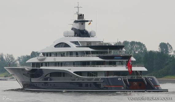
Vessel Tis IMO: 1013016, MMSI: 319165800 Passenger Ship
UTC, 4.26515, 73.48377, course: 73, speed: 0.1
UTC, 4.26560, 73.48358, course: 65, speed: 0.2
2026-01-17 03:41:38 UTC, 4.26502, 73.48383, course: 30, speed: 0.4
Live AIS position:
UTC. Near Hulhulé Island),
updated 2026-01-17 03:41:38 UTC.
Find the position of the vessel Tis on the map. The latter are known coordinates and path.
marine traffic ship tracker show on live map
The current position of vessel Tis is 4.26502 lat / 73.48383 lng. Updated: 2026-01-17 03:41:38 UTCCurrently sailing under the flag of Cayman Is
Details:
Last coordinates of the vessel:
UTC, 4.26520, 73.48360, course: 73, speed: 0.1UTC, 4.26515, 73.48377, course: 73, speed: 0.1
UTC, 4.26560, 73.48358, course: 65, speed: 0.2
2026-01-17 03:41:38 UTC, 4.26502, 73.48383, course: 30, speed: 0.4