 vesseltracker.com
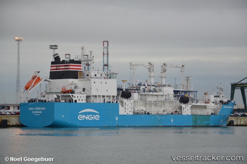
Vessel Engie Zeebrugge IMO: 9750024, MMSI: 205703000 Lng Tanker
UTC, 42.37642, 5.47109, course: 68, speed: 11.7
UTC, 42.37642, 5.47109, course: 68, speed: 11.7
2026-01-17 10:42:51 UTC, 42.37642, 5.47109, course: 68, speed: 11.7
Live AIS position:
UTC. 44 nm S of Toulon),
updated 2026-01-17 10:42:51 UTC.
Find the position of the vessel Engie Zeebrugge on the map. The latter are known coordinates and path.
marine traffic ship tracker show on live map
The current position of vessel Engie Zeebrugge is 42.37642 lat / 5.47109 lng. Updated: 2026-01-17 10:42:51 UTCDetails:
Last coordinates of the vessel:
UTC, 42.37642, 5.47109, course: 68, speed: 11.7UTC, 42.37642, 5.47109, course: 68, speed: 11.7
UTC, 42.37642, 5.47109, course: 68, speed: 11.7
2026-01-17 10:42:51 UTC, 42.37642, 5.47109, course: 68, speed: 11.7