 vesseltracker.com
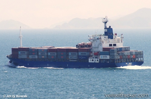
Find the position of the vessel St. Mary on the map. The latter are known coordinates and path.
marine traffic ship tracker show on live map
The current position of vessel St. Mary is 21.841606666667 lat / 91.696403333333 lng. Updated: 2025-09-12 15:19:56 UTCCurrently sailing under the flag of Cyprus
St. Mary built in 2001 year
Deadweight:
21579 tDetails:
Last coordinates of the vessel:
UTC, 22.294346666667, 91.79427, course: 192, speed: 0UTC, 22.258396666667, 91.836046666667, course: 194, speed: 11.1
UTC, 22.193318333333, 91.790478333333, course: 286, speed: 0.4
2025-09-12 15:19:56 UTC, 21.841606666667, 91.696403333333, course: 184, speed: 18