 vesseltracker.com
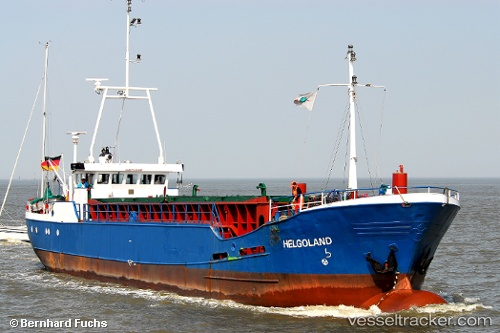
Vessel Helgoland IMO: 6417657, MMSI: 211286500 Multi Purpose Carrier
UTC, 53.21612, 7.45620, course: 357, speed: 0
UTC, 53.21615, 7.45622, course: 358, speed: 0
2026-01-13 14:26:49 UTC, 53.21615, 7.45617, course: 357, speed: 0
Live AIS position:
UTC. Near LEER),
updated 2026-01-13 14:26:49 UTC.
Find the position of the vessel Helgoland on the map. The latter are known coordinates and path.
marine traffic ship tracker show on live map
The current position of vessel Helgoland is 53.21615 lat / 7.45617 lng. Updated: 2026-01-13 14:26:49 UTCCurrently sailing under the flag of Germany
Helgoland built in 1964 year
Deadweight:
485 tDetails:
Last coordinates of the vessel:
UTC, 53.21500, 7.45500, course: -1, speed: 0UTC, 53.21612, 7.45620, course: 357, speed: 0
UTC, 53.21615, 7.45622, course: 358, speed: 0
2026-01-13 14:26:49 UTC, 53.21615, 7.45617, course: 357, speed: 0