 vesseltracker.com
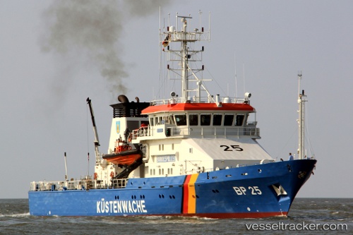
Vessel Bayreuth IMO: 9252632, MMSI: 211386450 Pollution Control Vessel
UTC, 54.60057, 11.16798, course: 295, speed: 13.7
UTC, 54.59070, 10.98383, course: 263, speed: 14.1
2026-01-17 17:23:08 UTC, 54.59070, 10.98383, course: 263, speed: 14.1
Live AIS position:
UTC. 10 nm SE of Süsel),
updated 2026-01-17 17:23:08 UTC.
Find the position of the vessel Bayreuth on the map. The latter are known coordinates and path.
marine traffic ship tracker show on live map
The current position of vessel Bayreuth is 54.59070 lat / 10.98383 lng. Updated: 2026-01-17 17:23:08 UTCCurrently sailing under the flag of Germany
Bayreuth built in 2003 year
Details:
Last coordinates of the vessel:
UTC, 54.56450, 11.30013, course: 295, speed: 14.3UTC, 54.60057, 11.16798, course: 295, speed: 13.7
UTC, 54.59070, 10.98383, course: 263, speed: 14.1
2026-01-17 17:23:08 UTC, 54.59070, 10.98383, course: 263, speed: 14.1