 vesseltracker.com
Live AIS position:
40.68332° N, 74.14988° W UTC. Near Maher Terminal),
updated 2025-11-22 17:36:45 UTC.
Find the position of the vessel Maureen S on the map. The latter are known coordinates and path.
marine traffic ship tracker show on live map
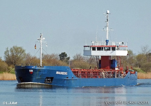
The current position of vessel Maureen S is 40.68332 lat / -74.14988 lng. Updated: 2025-11-22 17:36:45 UTCCurrently sailing under the flag of Cyprus
Maureen S built in 1985 year
Deadweight:
3357 tDetails:
Last coordinates of the vessel:
UTC, 40.68331, -74.14986, course: 310, speed: 0UTC, 40.68332, -74.14988, course: 309, speed: 0
UTC, 40.68332, -74.14988, course: 309, speed: 0
2025-11-22 17:36:45 UTC, 40.68332, -74.14988, course: 309, speed: 0