 vesseltracker.com
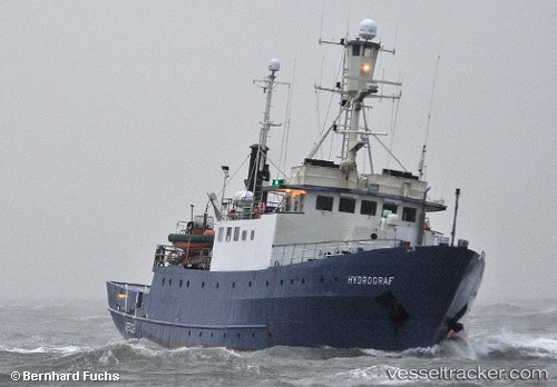
Vessel Hydrograf IMO: 6724440, MMSI: 218298000 Research Vessel
UTC, 53.8582, 8.71852, course: 313, speed: 0
UTC, 53.8582, 8.71851, course: 314, speed: 0
2026-02-18 19:45:33 UTC, 53.8581, 8.71839, course: 314, speed: 0
Live AIS position:
UTC. Near Cuxhaven),
updated 2026-02-18 19:45:33 UTC.
Find the position of the vessel Hydrograf on the map. The latter are known coordinates and path.
marine traffic ship tracker show on live map
The current position of vessel Hydrograf is 53.8581 lat / 8.71839 lng. Updated: 2026-02-18 19:45:33 UTCCurrently sailing under the flag of Germany
Hydrograf built in 1967 year
Deadweight:
351 tDetails:
Last coordinates of the vessel:
UTC, 53.8582, 8.71852, course: 313, speed: 0UTC, 53.8582, 8.71852, course: 313, speed: 0
UTC, 53.8582, 8.71851, course: 314, speed: 0
2026-02-18 19:45:33 UTC, 53.8581, 8.71839, course: 314, speed: 0