 vesseltracker.com
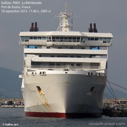
Vessel Kalliste IMO: 9050618, MMSI: 227202000 Passenger Ro Ro Cargo Ship
UTC, 43.33060, 5.34886, course: -1, speed: 0
UTC, 43.33059, 5.34886, course: -1, speed: 0
2026-01-16 05:44:41 UTC, 43.33059, 5.34885, course: -1, speed: 0
Live AIS position:
UTC. Near Marseille),
updated 2026-01-16 05:44:41 UTC.
Find the position of the vessel Kalliste on the map. The latter are known coordinates and path.
marine traffic ship tracker show on live map
The current position of vessel Kalliste is 43.33059 lat / 5.34885 lng. Updated: 2026-01-16 05:44:41 UTCCurrently sailing under the flag of France
Kalliste built in 1993 year
Deadweight:
9710 tDetails:
Last coordinates of the vessel:
UTC, 43.33060, 5.34885, course: -1, speed: 0UTC, 43.33060, 5.34886, course: -1, speed: 0
UTC, 43.33059, 5.34886, course: -1, speed: 0
2026-01-16 05:44:41 UTC, 43.33059, 5.34885, course: -1, speed: 0