 vesseltracker.com
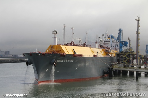
Vessel Corcovado Lng IMO: 9636711, MMSI: 229471000 Lng Tanker
UTC, 49.71666, -3.05508, course: 43, speed: 15
UTC, 50.01546, -1.83316, course: 74, speed: 15.3
2026-01-14 23:39:54 UTC, 50.04487, -1.68020, course: 75, speed: 15.4
Live AIS position:
UTC. 22 nm NE of Auderville),
updated 2026-01-14 23:39:54 UTC.
Find the position of the vessel Corcovado Lng on the map. The latter are known coordinates and path.
marine traffic ship tracker show on live map
The current position of vessel Corcovado Lng is 50.04487 lat / -1.68020 lng. Updated: 2026-01-14 23:39:54 UTCDetails:
Last coordinates of the vessel:
UTC, 49.56759, -3.28065, course: 50, speed: 14.5UTC, 49.71666, -3.05508, course: 43, speed: 15
UTC, 50.01546, -1.83316, course: 74, speed: 15.3
2026-01-14 23:39:54 UTC, 50.04487, -1.68020, course: 75, speed: 15.4