 vesseltracker.com
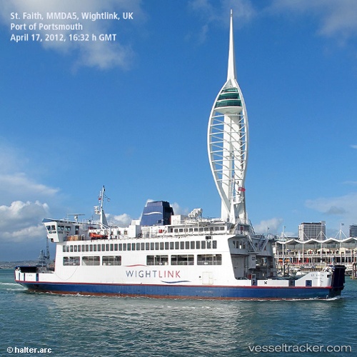
Vessel St Faith IMO: 8907228, MMSI: 235031618 Passenger Ro Ro Cargo Ship
UTC, 50.73562, -1.21186, course: 220, speed: 4
UTC, 50.79270, -1.10647, course: 299, speed: 0
2026-01-14 23:37:40 UTC, 50.79270, -1.10647, course: 298, speed: 0
Live AIS position:
UTC. Near GOSPORT),
updated 2026-01-14 23:37:40 UTC.
Find the position of the vessel St Faith on the map. The latter are known coordinates and path.
marine traffic ship tracker show on live map
The current position of vessel St Faith is 50.79270 lat / -1.10647 lng. Updated: 2026-01-14 23:37:40 UTCCurrently sailing under the flag of United Kingdom
St Faith built in 1990 year
Deadweight:
574 tDetails:
Last coordinates of the vessel:
UTC, 50.79298, -1.10753, course: 270, speed: 0UTC, 50.73562, -1.21186, course: 220, speed: 4
UTC, 50.79270, -1.10647, course: 299, speed: 0
2026-01-14 23:37:40 UTC, 50.79270, -1.10647, course: 298, speed: 0