 vesseltracker.com
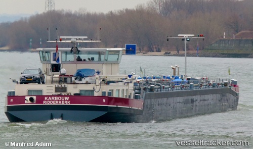
Vessel Karbouw IMO: 9286176, MMSI: 244660086 Other Tanker
UTC, 51.28293, 4.34585, course: -1, speed: 0
UTC, 51.28285, 4.34625, course: -1, speed: 0
2026-01-17 09:33:04 UTC, 51.28285, 4.34624, course: -1, speed: 0
Live AIS position:
UTC. Near Hoevenen),
updated 2026-01-17 09:33:04 UTC.
Find the position of the vessel Karbouw on the map. The latter are known coordinates and path.
marine traffic ship tracker show on live map
The current position of vessel Karbouw is 51.28285 lat / 4.34624 lng. Updated: 2026-01-17 09:33:04 UTCCurrently sailing under the flag of Netherlands
Details:
Last coordinates of the vessel:
UTC, 51.28296, 4.34590, course: -1, speed: 0UTC, 51.28293, 4.34585, course: -1, speed: 0
UTC, 51.28285, 4.34625, course: -1, speed: 0
2026-01-17 09:33:04 UTC, 51.28285, 4.34624, course: -1, speed: 0