 vesseltracker.com
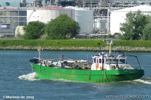
Vessel Bru 14 Luctor Et IMO: 8952869, MMSI: 245336000 Fishing Vessel
UTC, 51.66531, 4.09565, course: 209, speed: 0
UTC, 51.66531, 4.09565, course: 208, speed: 0
2026-01-13 20:48:03 UTC, 51.66533, 4.09565, course: 209, speed: 0
Live AIS position:
UTC. Near BRUINISSE),
updated 2026-01-13 20:48:03 UTC.
Find the position of the vessel Bru 14 Luctor Et on the map. The latter are known coordinates and path.
marine traffic ship tracker show on live map
The current position of vessel Bru 14 Luctor Et is 51.66533 lat / 4.09565 lng. Updated: 2026-01-13 20:48:03 UTCCurrently sailing under the flag of Netherlands
Details:
Last coordinates of the vessel:
UTC, 51.66533, 4.09563, course: 209, speed: 0UTC, 51.66531, 4.09565, course: 209, speed: 0
UTC, 51.66531, 4.09565, course: 208, speed: 0
2026-01-13 20:48:03 UTC, 51.66533, 4.09565, course: 209, speed: 0