 vesseltracker.com
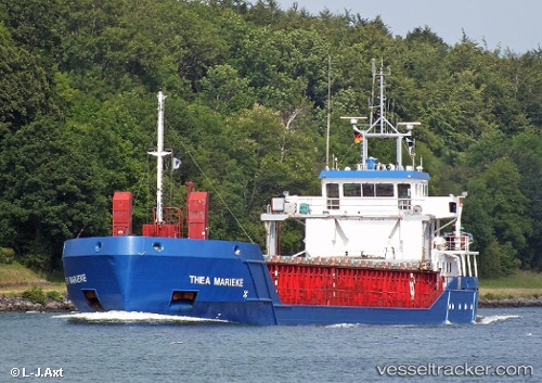
Vessel Thea Marieke IMO: 9195418, MMSI: 246064000 General Cargo Ship
UTC, 43.31637, -3.00166, course: 116, speed: 0
UTC, 43.31637, -3.00165, course: 117, speed: 0
2026-01-13 21:29:13 UTC, 43.31638, -3.00165, course: 117, speed: 0
Live AIS position:
UTC. Near Santurtz),
updated 2026-01-13 21:29:13 UTC.
Find the position of the vessel Thea Marieke on the map. The latter are known coordinates and path.
marine traffic ship tracker show on live map
The current position of vessel Thea Marieke is 43.31638 lat / -3.00165 lng. Updated: 2026-01-13 21:29:13 UTCCurrently sailing under the flag of Netherlands
Thea Marieke built in 2001 year
Deadweight:
3149 tDetails:
Last coordinates of the vessel:
UTC, 43.31635, -3.00167, course: 117, speed: 0UTC, 43.31637, -3.00166, course: 116, speed: 0
UTC, 43.31637, -3.00165, course: 117, speed: 0
2026-01-13 21:29:13 UTC, 43.31638, -3.00165, course: 117, speed: 0