 vesseltracker.com
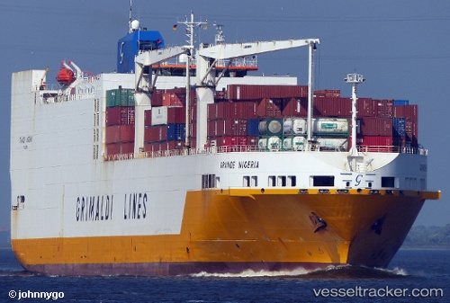
Vessel Grande Nigeria IMO: 9246580, MMSI: 247082500 Vehicles Carrier
UTC, 51.35464, 3.88659, course: 240, speed: 15.4
UTC, 51.38017, 2.91212, course: 260, speed: 13.6
2026-01-17 09:33:03 UTC, 51.37747, 2.88584, course: 260, speed: 13.9
Live AIS position:
UTC. Near De Haan),
updated 2026-01-17 09:33:03 UTC.
Find the position of the vessel Grande Nigeria on the map. The latter are known coordinates and path.
marine traffic ship tracker show on live map
The current position of vessel Grande Nigeria is 51.37747 lat / 2.88584 lng. Updated: 2026-01-17 09:33:03 UTCDetails:
Last coordinates of the vessel:
UTC, 51.27915, 4.24763, course: 33, speed: 0UTC, 51.35464, 3.88659, course: 240, speed: 15.4
UTC, 51.38017, 2.91212, course: 260, speed: 13.6
2026-01-17 09:33:03 UTC, 51.37747, 2.88584, course: 260, speed: 13.9