 vesseltracker.com
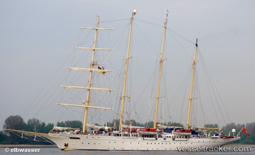
Vessel Star Flyer IMO: 8915433, MMSI: 248785000 Cruise Ship
UTC, 17.01065, -61.78255, course: 107, speed: 0
UTC, 17.01072, -61.78257, course: 90, speed: 0
2026-01-15 16:28:26 UTC, 17.01062, -61.78253, course: 100, speed: 0
Live AIS position:
UTC. Near Falmouth),
updated 2026-01-15 16:28:26 UTC.
Find the position of the vessel Star Flyer on the map. The latter are known coordinates and path.
marine traffic ship tracker show on live map
The current position of vessel Star Flyer is 17.01062 lat / -61.78253 lng. Updated: 2026-01-15 16:28:26 UTCCurrently sailing under the flag of Malta
Star Flyer built in 1991 year
Deadweight:
300 tDetails:
Last coordinates of the vessel:
UTC, 17.01067, -61.78253, course: 109, speed: 0.1UTC, 17.01065, -61.78255, course: 107, speed: 0
UTC, 17.01072, -61.78257, course: 90, speed: 0
2026-01-15 16:28:26 UTC, 17.01062, -61.78253, course: 100, speed: 0