 vesseltracker.com
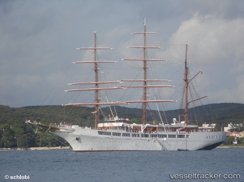
Vessel Sea Cloud Ii IMO: 9171292, MMSI: 248953000 Cruise Ship
UTC, 16.23793, -61.53951, course: 192, speed: 0
UTC, 16.23688, -61.53990, course: 174, speed: 2.8
2026-01-17 22:35:23 UTC, 16.19575, -61.52479, course: 159, speed: 8.1
Live AIS position:
UTC. Near Pointe-à-Pitre),
updated 2026-01-17 22:35:23 UTC.
Find the position of the vessel Sea Cloud Ii on the map. The latter are known coordinates and path.
marine traffic ship tracker show on live map
The current position of vessel Sea Cloud Ii is 16.19575 lat / -61.52479 lng. Updated: 2026-01-17 22:35:23 UTCCurrently sailing under the flag of Malta
Sea Cloud Ii built in 2000 year
Deadweight:
379 tDetails:
Last coordinates of the vessel:
UTC, 16.23791, -61.53950, course: 192, speed: 0UTC, 16.23793, -61.53951, course: 192, speed: 0
UTC, 16.23688, -61.53990, course: 174, speed: 2.8
2026-01-17 22:35:23 UTC, 16.19575, -61.52479, course: 159, speed: 8.1