 vesseltracker.com
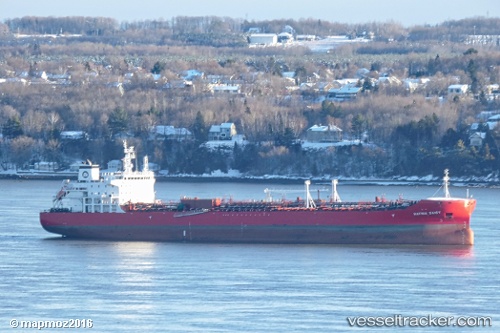
Vessel Hafnia Daisy IMO: 9709788, MMSI: 249347000 Chemical Oil Products Tanker
UTC, 48.02842, -69.63891, course: 26, speed: 13.7
UTC, 48.16963, -69.52765, course: 35, speed: 13.6
2026-01-14 22:49:42 UTC, 48.65956, -68.49867, course: 57, speed: 13.3
Live AIS position:
UTC. 11 nm N of Saint-Anaclet),
updated 2026-01-14 22:49:42 UTC.
Find the position of the vessel Hafnia Daisy on the map. The latter are known coordinates and path.
marine traffic ship tracker show on live map
The current position of vessel Hafnia Daisy is 48.65956 lat / -68.49867 lng. Updated: 2026-01-14 22:49:42 UTCCurrently sailing under the flag of Malta
Details:
Last coordinates of the vessel:
UTC, 47.80910, -69.82431, course: 33, speed: 12.7UTC, 48.02842, -69.63891, course: 26, speed: 13.7
UTC, 48.16963, -69.52765, course: 35, speed: 13.6
2026-01-14 22:49:42 UTC, 48.65956, -68.49867, course: 57, speed: 13.3