 vesseltracker.com
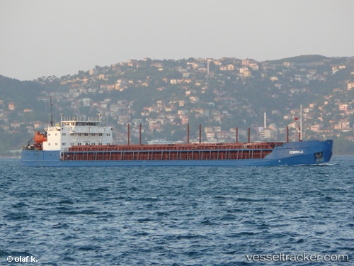
Vessel Seminole IMO: 8890396, MMSI: 249559000 General Cargo Ship
UTC, 39.42608, -0.32899, course: 19, speed: 1.2
UTC, 39.42601, -0.32880, course: 19, speed: 0.8
2026-01-13 13:51:28 UTC, 39.42589, -0.32997, course: 19, speed: 2.7
Live AIS position:
UTC. Near Valencia),
updated 2026-01-13 13:51:28 UTC.
Find the position of the vessel Seminole on the map. The latter are known coordinates and path.
marine traffic ship tracker show on live map
The current position of vessel Seminole is 39.42589 lat / -0.32997 lng. Updated: 2026-01-13 13:51:28 UTCCurrently sailing under the flag of Malta
Seminole built in 1995 year
Deadweight:
5107 tDetails:
Last coordinates of the vessel:
UTC, 39.42604, -0.32886, course: 18, speed: 1.1UTC, 39.42608, -0.32899, course: 19, speed: 1.2
UTC, 39.42601, -0.32880, course: 19, speed: 0.8
2026-01-13 13:51:28 UTC, 39.42589, -0.32997, course: 19, speed: 2.7