 vesseltracker.com
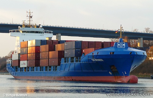
Vessel Meandi IMO: 9328039, MMSI: 255805841 Container Ship
UTC, 36.53732, -6.28737, course: 42, speed: 0.1
UTC, 36.53733, -6.28741, course: 42, speed: 0
2026-01-17 20:02:22 UTC, 36.53729, -6.28742, course: 42, speed: 0
Live AIS position:
UTC. Near Cadiz),
updated 2026-01-17 20:02:22 UTC.
Find the position of the vessel Meandi on the map. The latter are known coordinates and path.
marine traffic ship tracker show on live map
The current position of vessel Meandi is 36.53729 lat / -6.28742 lng. Updated: 2026-01-17 20:02:22 UTCCurrently sailing under the flag of Portugal
Meandi built in 2006 year
Deadweight:
9350 tDetails:
Last coordinates of the vessel:
UTC, 36.53747, -6.28726, course: 42, speed: 0.1UTC, 36.53732, -6.28737, course: 42, speed: 0.1
UTC, 36.53733, -6.28741, course: 42, speed: 0
2026-01-17 20:02:22 UTC, 36.53729, -6.28742, course: 42, speed: 0