 vesseltracker.com
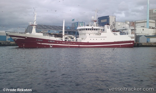
Vessel Storeknut IMO: 9143570, MMSI: 259242000 Fish Carrier
UTC, 60.11487, 5.16401, course: 62, speed: 0
UTC, 60.11486, 5.16400, course: 62, speed: 0
2026-01-15 03:35:27 UTC, 60.11490, 5.16398, course: 62, speed: 0
Live AIS position:
UTC. Near TORANGSVAG),
updated 2026-01-15 03:35:27 UTC.
Find the position of the vessel Storeknut on the map. The latter are known coordinates and path.
marine traffic ship tracker show on live map
The current position of vessel Storeknut is 60.11490 lat / 5.16398 lng. Updated: 2026-01-15 03:35:27 UTCCurrently sailing under the flag of Norway
Details:
Last coordinates of the vessel:
UTC, 60.11487, 5.16400, course: 62, speed: 0UTC, 60.11487, 5.16401, course: 62, speed: 0
UTC, 60.11486, 5.16400, course: 62, speed: 0
2026-01-15 03:35:27 UTC, 60.11490, 5.16398, course: 62, speed: 0