 vesseltracker.com
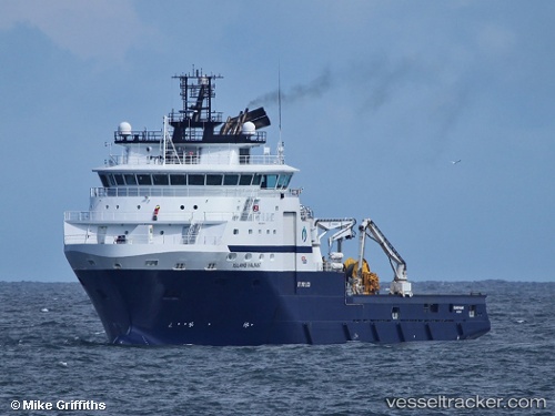
Vessel Island Valiant IMO: 9356191, MMSI: 259367000 Offshore Tug Supply Ship
UTC, 60.40144, 5.30899, course: 285, speed: 0
UTC, 60.40143, 5.30899, course: 284, speed: 0
2026-01-16 17:33:36 UTC, 60.40142, 5.30900, course: 285, speed: 0
Live AIS position:
UTC. Near Bergen),
updated 2026-01-16 17:33:36 UTC.
Find the position of the vessel Island Valiant on the map. The latter are known coordinates and path.
marine traffic ship tracker show on live map
The current position of vessel Island Valiant is 60.40142 lat / 5.30900 lng. Updated: 2026-01-16 17:33:36 UTCCurrently sailing under the flag of Norway
Island Valiant built in 2007 year
Deadweight:
5172 tDetails:
Last coordinates of the vessel:
UTC, 60.40143, 5.30903, course: 285, speed: 0UTC, 60.40144, 5.30899, course: 285, speed: 0
UTC, 60.40143, 5.30899, course: 284, speed: 0
2026-01-16 17:33:36 UTC, 60.40142, 5.30900, course: 285, speed: 0