 vesseltracker.com
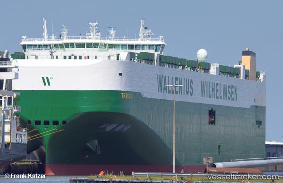
Vessel Traviata IMO: 9700524, MMSI: 265012000 Vehicles Carrier
UTC, 33.09970, 134.24449, course: 40, speed: 18.8
UTC, 33.40039, 134.56216, course: 33, speed: 9.2
2026-01-16 13:38:30 UTC, 33.44148, 134.59409, course: 32, speed: 9.3
Live AIS position:
UTC. 16 nm SE of KANNOURA),
updated 2026-01-16 13:38:30 UTC.
Find the position of the vessel Traviata on the map. The latter are known coordinates and path.
marine traffic ship tracker show on live map
The current position of vessel Traviata is 33.44148 lat / 134.59409 lng. Updated: 2026-01-16 13:38:30 UTCCurrently sailing under the flag of Sweden
Details:
Last coordinates of the vessel:
UTC, 32.81062, 133.83054, course: 73, speed: 19UTC, 33.09970, 134.24449, course: 40, speed: 18.8
UTC, 33.40039, 134.56216, course: 33, speed: 9.2
2026-01-16 13:38:30 UTC, 33.44148, 134.59409, course: 32, speed: 9.3