 vesseltracker.com
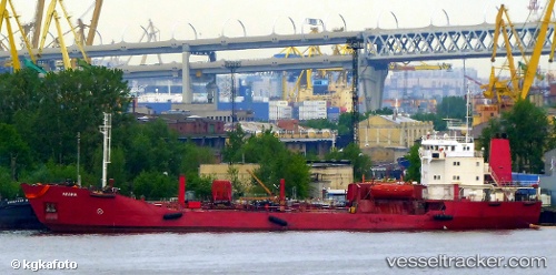
Find the position of the vessel ANGARA on the map. The latter are known coordinates and path.
marine traffic ship tracker show on live map
The current position of vessel ANGARA is 76.75027 lat / 90.33009 lng. Updated: 2025-10-23 03:13:45 UTCCurrently sailing under the flag of Russia
ANGARA built in 1982 year
Deadweight:
3233 tDetails:
Last coordinates of the vessel:
UTC, 77.21196, 94.09444, course: 236, speed: 10.6UTC, 77.06617, 92.65026, course: 241, speed: 10.1
UTC, 76.92216, 91.47830, course: 240, speed: 10.2
2025-10-23 03:13:45 UTC, 76.75027, 90.33009, course: 237, speed: 10.1