vessel POLA IMABARI IMO: 9759666, Bulk Carrier vesseltracker.com
Vessel POLA IMABARI IMO: 9759666, Bulk Carrier
MMSI: 273615220 callsign: UBPX2 size: x

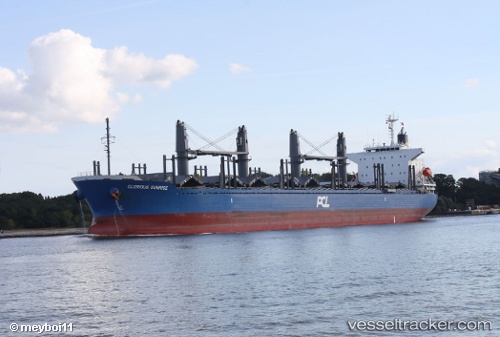
Find the position of the vessel POLA IMABARI on the map. The latter are known coordinates and path.

marine traffic ship tracker show on live map

The current position of vessel POLA IMABARI is 69.0113 lat / 33.0862 lng. Updated: 2025-07-07 02:49:02 UTC

Currently sailing under the flag of Russia

POLA IMABARI built in 2016 year

Deadweight:
37718 t

Details:


Last coordinates of the vessel:
UTC, 69.0113, 33.0862, course: 217, speed: 52.4
2025-07-07 02:49:02 UTC, 69.0113, 33.0862, course: 217, speed: 52.4

The ship also appears on the maps:


Most frequent ports a vessels calls at POLA IMABARI (273615220):

Santos, traffic: 3
Paranagua, traffic: 2
Ruch’I, traffic: 2
Istanbul, traffic: 1
Korsor, traffic: 1
Skagens Odde, traffic: 1
Baltiysk, traffic: 1
Ust-Luga, traffic: 1

Link to the map:


Find another ship

POLA_IMABARI (273615220) last ports (portcalls and passsages)

Istanbul | 2022-10-18 13:17:17
Ust-Luga | 2022-05-26 07:25:28
Baltiysk | 2022-05-13 13:17:11
Korsor | 2022-05-06 04:02:05
Skagens Odde | 2022-05-05 13:27:49
Santos | 2022-04-12 00:23:48
Paranagua | 2022-02-22 03:22:49
Santos | 2021-12-06 15:15:43
Ruch’I | 2021-09-30 16:13:11