 vesseltracker.com
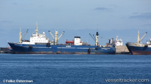
Find the position of the vessel Ieva Simonaityte on the map. The latter are known coordinates and path.
marine traffic ship tracker show on live map
The current position of vessel Ieva Simonaityte is 17.9901 lat / -16.0358 lng. Updated: 2025-09-11 21:32:12 UTCCurrently sailing under the flag of Lithuania
Ieva Simonaityte built in 1989 year
Deadweight:
3915 tDetails:
Last coordinates of the vessel:
UTC, 17.9901, -16.0357, course: 56, speed: 0.1UTC, 17.9901, -16.0357, course: 56, speed: 0
UTC, 17.9901, -16.0357, course: 56, speed: 0
2025-09-11 21:32:12 UTC, 17.9901, -16.0358, course: 56, speed: 0.1
The ship also appears on the maps: