 vesseltracker.com
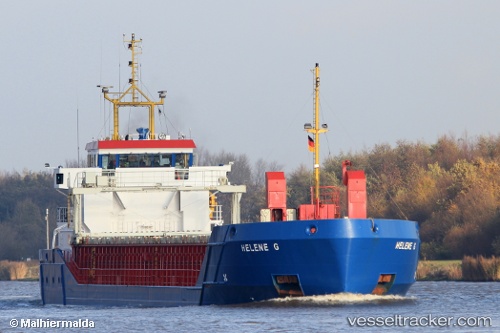
Find the position of the vessel Helene G on the map. The latter are known coordinates and path.
marine traffic ship tracker show on live map
The current position of vessel Helene G is 51.31630 lat / 3.83030 lng. Updated: 2025-10-18 15:03:04 UTCCurrently sailing under the flag of Antigua Barbuda
Helene G built in 2001 year
Deadweight:
3156 tDetails:
Last coordinates of the vessel:
UTC, 51.31630, 3.83025, course: -1, speed: 0UTC, 51.31630, 3.83028, course: -1, speed: 0
UTC, 51.31628, 3.83030, course: -1, speed: 0
2025-10-18 15:03:04 UTC, 51.31630, 3.83030, course: -1, speed: 0