 vesseltracker.com
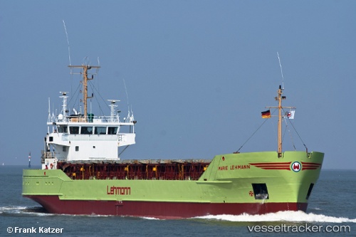
Find the position of the vessel Marie b on the map. The latter are known coordinates and path.
marine traffic ship tracker show on live map
The current position of vessel Marie b is 54.03538 lat / 13.76102 lng. Updated: 2025-10-26 13:19:35 UTCCurrently sailing under the flag of Antigua Barbuda
Marie b built in 1987 year
Deadweight:
3017 tDetails:
Last coordinates of the vessel:
UTC, 54.03710, 13.76541, course: 53, speed: 0.6UTC, 54.03710, 13.76541, course: 53, speed: 0.6
UTC, 54.03538, 13.76102, course: 58, speed: 0
2025-10-26 13:19:35 UTC, 54.03538, 13.76102, course: 58, speed: 0