 vesseltracker.com
Find the position of the vessel RIGHT STEP on the map. The latter are known coordinates and path.
marine traffic ship tracker show on live map
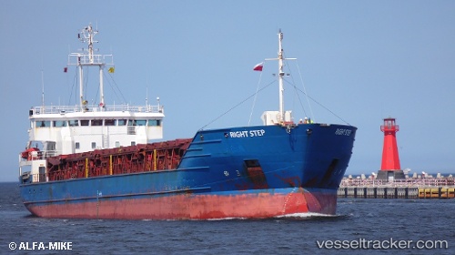
The current position of vessel RIGHT STEP is 43.56167 lat / 10.30166 lng. Updated: 2025-11-18 01:50:53 UTCCurrently sailing under the flag of Antigua and Barbuda
RIGHT STEP built in 1996 year
Deadweight:
5200 tDetails:
Last coordinates of the vessel:
UTC, 43.56167, 10.30166, course: -1, speed: 0UTC, 43.56271, 10.30297, course: 194, speed: 0.1
UTC, 43.56167, 10.30166, course: -1, speed: 0
2025-11-18 01:50:53 UTC, 43.56167, 10.30166, course: -1, speed: 0