 vesseltracker.com
Find the position of the vessel Bontrup Amsterdam on the map. The latter are known coordinates and path.
marine traffic ship tracker show on live map
The current position of vessel Bontrup Amsterdam is 56.568531666667 lat / -5.5310783333333 lng. Updated: 2025-09-12 23:19:14 UTCCurrently sailing under the flag of Bahamas
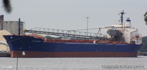
Bontrup Amsterdam built in 1984 year
Deadweight:
59960 tDetails:
Last coordinates of the vessel:
UTC, 56.568535, -5.5311116666667, course: 223, speed: 0UTC, 56.568526666667, -5.5310783333333, course: 223, speed: 0
UTC, 56.56853, -5.53109, course: 223, speed: 0
2025-09-12 23:19:14 UTC, 56.568531666667, -5.5310783333333, course: 223, speed: 0