 vesseltracker.com
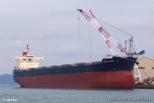
Vessel Energy Sunrise IMO: 9582544, MMSI: 351988000 Bulk Carrier
UTC, 6.50281, 58.75120, course: 29, speed: 11.1
UTC, 6.90577, 58.95101, course: 31, speed: 11.4
2026-01-13 17:26:12 UTC, 7.53305, 59.21364, course: 23, speed: 11.8
Live AIS position:
UTC. Open sea, approx. 429 nm off the nearest listed port),
updated 2026-01-13 17:26:12 UTC.
Find the position of the vessel Energy Sunrise on the map. The latter are known coordinates and path.
marine traffic ship tracker show on live map
The current position of vessel Energy Sunrise is 7.53305 lat / 59.21364 lng. Updated: 2026-01-13 17:26:12 UTCCurrently sailing under the flag of Panama
Details:
Last coordinates of the vessel:
UTC, 6.18030, 58.58705, course: 31, speed: 10.9UTC, 6.50281, 58.75120, course: 29, speed: 11.1
UTC, 6.90577, 58.95101, course: 31, speed: 11.4
2026-01-13 17:26:12 UTC, 7.53305, 59.21364, course: 23, speed: 11.8