 vesseltracker.com
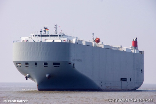
Find the position of the vessel Galveston Highway on the map. The latter are known coordinates and path.
marine traffic ship tracker show on live map
The current position of vessel Galveston Highway is 35.523 lat / 129.39 lng. Updated: 2025-06-17 11:52:45 UTCCurrently sailing under the flag of Panama
Payload_mass:
18549 tonneGross tonnage:
59525Service entry:
2014-01-01T00:00:00ZManufacturer:
Imabari Shipbuilding Marugame Headquarters (Shipyard in Japan)
Details:
Last coordinates of the vessel:
UTC, 35.523, 129.39, course: 332, speed: 0UTC, 35.523, 129.39, course: 332, speed: 0
UTC, 35.523, 129.39, course: 332, speed: 0
2025-06-17 11:52:45 UTC, 35.523, 129.39, course: 332, speed: 0