 vesseltracker.com
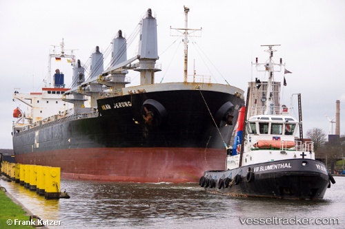
Vessel Ikan Jerung IMO: 9409584, MMSI: 353150000 Bulk Carrier
UTC, 35.52897, 35.75836, course: -1, speed: 0.1
UTC, 35.52897, 35.75836, course: -1, speed: 0.1
2026-01-11 16:53:38 UTC, 35.52897, 35.75836, course: -1, speed: 0.1
Live AIS position:
UTC. Near Al Latakia),
updated 2026-01-11 16:53:38 UTC.
Find the position of the vessel Ikan Jerung on the map. The latter are known coordinates and path.
marine traffic ship tracker show on live map
The current position of vessel Ikan Jerung is 35.52897 lat / 35.75836 lng. Updated: 2026-01-11 16:53:38 UTCDetails:
Last coordinates of the vessel:
UTC, 35.52897, 35.75836, course: -1, speed: 0.1UTC, 35.52897, 35.75836, course: -1, speed: 0.1
UTC, 35.52897, 35.75836, course: -1, speed: 0.1
2026-01-11 16:53:38 UTC, 35.52897, 35.75836, course: -1, speed: 0.1