 vesseltracker.com
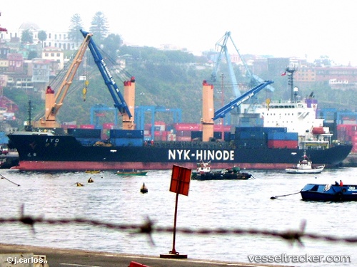
Vessel Iyo IMO: 9300879, MMSI: 353791000 Multi Purpose Carrier
UTC, 34.14834, 135.19278, course: 86, speed: 0
UTC, 34.14830, 135.19275, course: 86, speed: 0
2026-01-13 09:41:39 UTC, 34.14830, 135.19272, course: 86, speed: 0
Live AIS position:
UTC. Near Wakayama),
updated 2026-01-13 09:41:39 UTC.
Find the position of the vessel Iyo on the map. The latter are known coordinates and path.
marine traffic ship tracker show on live map
The current position of vessel Iyo is 34.14830 lat / 135.19272 lng. Updated: 2026-01-13 09:41:39 UTCDetails:
Last coordinates of the vessel:
UTC, 34.14831, 135.19275, course: 87, speed: 0UTC, 34.14834, 135.19278, course: 86, speed: 0
UTC, 34.14830, 135.19275, course: 86, speed: 0
2026-01-13 09:41:39 UTC, 34.14830, 135.19272, course: 86, speed: 0