 vesseltracker.com
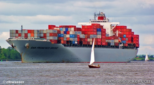
Find the position of the vessel San Francisco Bridge on the map. The latter are known coordinates and path.
marine traffic ship tracker show on live map
The current position of vessel San Francisco Bridge is 39.01618 lat / 117.77115 lng. Updated: 2025-10-10 19:38:07 UTCCurrently sailing under the flag of Panama
San Francisco Bridge built in 2010 year
Deadweight:
72890 tDetails:
Last coordinates of the vessel:
UTC, 39.01618, 117.77112, course: 347, speed: 0UTC, 39.01618, 117.77110, course: 347, speed: 0
UTC, 39.01617, 117.77115, course: 347, speed: 0
2025-10-10 19:38:07 UTC, 39.01618, 117.77115, course: 347, speed: 0