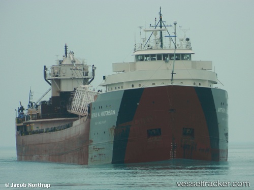
vessel Arthur M. Anderson IMO: 5025691, Self Discharging Bulk Carrier
Vessel Arthur M. Anderson IMO: 5025691, Self Discharging Bulk Carrier
MMSI: 366972020 callsign: WDG7087 size: 234x234

Find the position of the vessel Arthur M. Anderson on the map. The latter are known coordinates and path.

marine traffic ship tracker show on live map

The current position of vessel Arthur M. Anderson is 43.9934 lat / -86.6241 lng. Updated: 2024-11-24 04:35:11 UTC

Currently sailing under the flag of USA

Arthur M. Anderson built in 1952 year

Deadweight:
27129 t

Gross tonnage:
12341
Service entry:
1952-01-01T00:00:00Z
Named after:
Arthur Marvin Anderson (American banker)

Manufacturer:
American Ship Building Company (Shipbuilder company in North America)
Details:


Last coordinates of the vessel:
UTC, 43.4867, -86.645, course: 341, speed: 11.6
UTC, 43.6796, -86.6935, course: 7, speed: 11.9
UTC, 43.8345, -86.6591, course: 7, speed: 12
2024-11-24 04:35:11 UTC, 43.9934, -86.6241, course: 7, speed: 12


Most frequent ports a vessels calls at Arthur M. Anderson (366972020):

MUSKEGON, traffic: 1
TWO HARBORS, traffic: 1

Link to the map:


Find another ship

Arthur_M._Anderson (366972020) last ports (portcalls and passsages)

MUSKEGON | 2024-11-22 13:47:13
TWO HARBORS | 2024-11-15 00:31:30