 vesseltracker.com
Live AIS position:
46.69733° N, 92.01856° W UTC. Near Proctor),
updated 2025-11-19 17:49:22 UTC.
Find the position of the vessel Stewart J Cort on the map. The latter are known coordinates and path.
marine traffic ship tracker show on live map
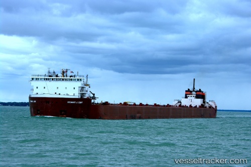
The current position of vessel Stewart J Cort is 46.69733 lat / -92.01856 lng. Updated: 2025-11-19 17:49:22 UTCCurrently sailing under the flag of USA
Stewart J Cort built in 1971 year
Deadweight:
60079 tDetails:
Last coordinates of the vessel:
UTC, 46.70208, -92.01909, course: 171, speed: 0.9UTC, 46.69667, -92.01833, course: -1, speed: 0
UTC, 46.69667, -92.01833, course: -1, speed: 0
2025-11-19 17:49:22 UTC, 46.69733, -92.01856, course: 180, speed: 0