 vesseltracker.com
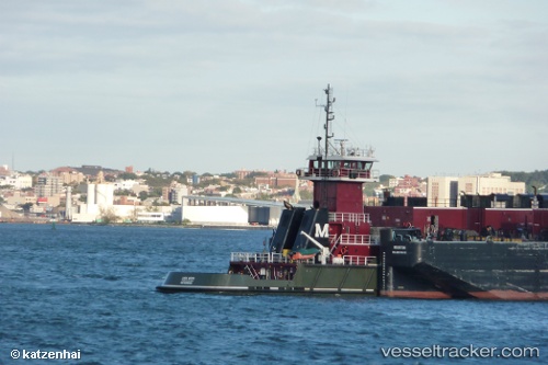
Vessel Linda Moran IMO: 9398565, MMSI: 367349860 Pusher Tug
UTC, 30.10967, -90.95730, course: 90, speed: 10.6
UTC, 29.99753, -90.79396, course: 48, speed: 10.2
2026-01-15 10:38:41 UTC, 30.01643, -90.75893, course: 89, speed: 10.6
Live AIS position:
UTC. Near Saint James Parish),
updated 2026-01-15 10:38:41 UTC.
Find the position of the vessel Linda Moran on the map. The latter are known coordinates and path.
marine traffic ship tracker show on live map
The current position of vessel Linda Moran is 30.01643 lat / -90.75893 lng. Updated: 2026-01-15 10:38:41 UTCCurrently sailing under the flag of USA
Linda Moran built in 2008 year
Deadweight:
101 tDetails:
Last coordinates of the vessel:
UTC, 30.16202, -91.00345, course: 160, speed: 10.5UTC, 30.10967, -90.95730, course: 90, speed: 10.6
UTC, 29.99753, -90.79396, course: 48, speed: 10.2
2026-01-15 10:38:41 UTC, 30.01643, -90.75893, course: 89, speed: 10.6