 vesseltracker.com
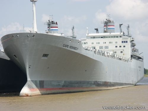
Vessel Cape Kennedy IMO: 7714636, MMSI: 367802000 Vehicles Carrier
UTC, 29.95790, -90.03199, course: 286, speed: 0
UTC, 29.95667, -90.03167, course: -1, speed: 0
2026-01-15 10:39:00 UTC, 29.95789, -90.03197, course: 286, speed: 0
Live AIS position:
UTC. Near New Orleans),
updated 2026-01-15 10:39:00 UTC.
Find the position of the vessel Cape Kennedy on the map. The latter are known coordinates and path.
marine traffic ship tracker show on live map
The current position of vessel Cape Kennedy is 29.95789 lat / -90.03197 lng. Updated: 2026-01-15 10:39:00 UTCCurrently sailing under the flag of USA
Cape Kennedy built in 1979 year
Deadweight:
29218 tDetails:
Last coordinates of the vessel:
UTC, 29.95790, -90.03200, course: 286, speed: 0UTC, 29.95790, -90.03199, course: 286, speed: 0
UTC, 29.95667, -90.03167, course: -1, speed: 0
2026-01-15 10:39:00 UTC, 29.95789, -90.03197, course: 286, speed: 0