 vesseltracker.com
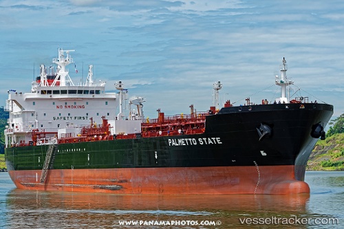
Live AIS position:
33.64671° N, 118.48788° W UTC. Near Rolling Hills),
updated 2025-11-20 02:52:52 UTC.
Find the position of the vessel Palmetto State on the map. The latter are known coordinates and path.
marine traffic ship tracker show on live map
The current position of vessel Palmetto State is 33.64671 lat / -118.48788 lng. Updated: 2025-11-20 02:52:52 UTCCurrently sailing under the flag of USA
Details:
Last coordinates of the vessel:
UTC, 33.76098, -118.26701, course: 218, speed: 0UTC, 33.72336, -118.27060, course: 161, speed: 6.8
UTC, 33.63585, -118.35201, course: 270, speed: 10
2025-11-20 02:52:52 UTC, 33.64671, -118.48788, course: 280, speed: 9.8