 vesseltracker.com
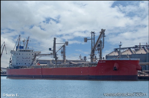
Vessel Flag Evi IMO: 9619799, MMSI: 373562000 Bulk Carrier
UTC, 53.46029, -3.01612, course: 248, speed: 0.1
UTC, 53.46028, -3.01619, course: 248, speed: 0
2026-01-13 14:07:57 UTC, 53.46030, -3.01620, course: 248, speed: 0
Live AIS position:
UTC. Near Seaforth),
updated 2026-01-13 14:07:57 UTC.
Find the position of the vessel Flag Evi on the map. The latter are known coordinates and path.
marine traffic ship tracker show on live map
The current position of vessel Flag Evi is 53.46030 lat / -3.01620 lng. Updated: 2026-01-13 14:07:57 UTCCurrently sailing under the flag of Panama
Flag Evi built in 2014 year
Deadweight:
82000 tDetails:
Last coordinates of the vessel:
UTC, 53.46030, -3.01618, course: 248, speed: 0UTC, 53.46029, -3.01612, course: 248, speed: 0.1
UTC, 53.46028, -3.01619, course: 248, speed: 0
2026-01-13 14:07:57 UTC, 53.46030, -3.01620, course: 248, speed: 0